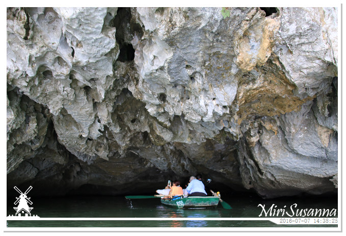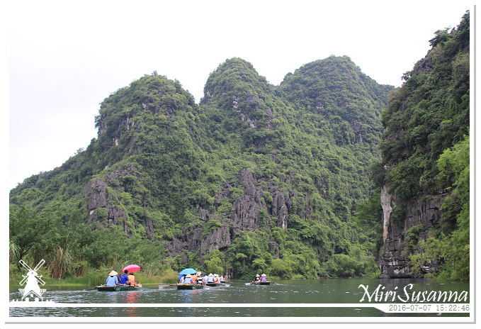
位於紅河三角洲南緣地帶的寧平,曾經是越南古都華閭(Hoa Lư)的所在地,擁有不少文化古蹟。其市郊的三谷(Tam Cốc)的喀斯特自然景觀被譽為陸上的下龍灣,或陸龍灣。長安生態景區涵蓋華閭與三谷,是越南唯一一處自然與人文雙重的世界遺產。來陸龍灣坐船賞景的路線有兩條:從華閭到三谷往返,或在長安上船遊三谷的洞穴。我們是在長安坐鐵皮船,讓船夫搖船,輕輕鬆鬆地欣賞陸龍灣的景觀,間中穿過大小不同的岩洞,全程兩個小時。在穿過岩洞的當兒,有的得彎腰低頭,有的則不斷“下雨”而不得為相機找庇護,緊張刺激。走過了下龍灣和陸龍灣,心裡開始期盼親睹桂林山水的一天。
[NL] Zoals voorgesteld bij UNESCO (Official website): “Trang An ligt aan de zuidelijke oever van de Rode rivierdelta. Het is een spectaculair landschap van kalkstenen karstpieken doortrokken met valleien, sommige onder water en omgeven door steile, bijna verticale kliffen. De verkenning van enkele van de hoogste, over het landschap verspreide hoogtegrotten leverde archeologische sporen op van menselijke activiteit daterend van bijna 30.000 jaar geleden. Ze tonen aan dat deze bergen bewoond werden door jager-verzamelaars en laten zien hoe zij zich aanpasten aan de klimatologische en ecologische veranderingen. Het landschapscomplex herbergt ook Hoa Lu – de oude hoofdstad van Vietnam in de 10e en 11e eeuw – tempels en pagodes. Trang An kent ook rijstveldlandschappen met dorpen en heilige plaatsen.” We hebben een boottocht van 2 uur gehad om het spectaculaire uitzicht in dit gebied te bewonderen, tussentijds zijn we door verschillende grotten gevaren.
[EN] Trang An Landscape Complex, as introduced in UNESCO (Official website): “Situated near the southern margin of the Red River Delta, the Trang An Landscape Complex is a spectacular landscape of limestone karst peaks permeated with valleys, many of them partly submerged and surrounded by steep, almost vertical cliffs. Exploration of caves at different altitudes has revealed archaeological traces of human activity over a continuous period of more than 30,000 years. They illustrate the occupation of these mountains by seasonal hunter-gatherers and how they adapted to major climatic and environmental changes, especially the repeated inundation of the landscape by the sea after the last ice age. The story of human occcupation continues through the Neolithic and Bronze Ages to the historical era. Hoa Lu, the ancient capital of Viet Nam, was strategically established here in the 10th and 11th centuries AD. The property also contains temples, pagodas, paddy-fields and small villages.” We had a 2 hours boat tour to enjoy the spectacular scenery of this area, including rowing through limestone caves. Continue reading →


