
繼續回味!
Continue the show…….
Continue reading
繼續回味!
Continue the show…….
Continue reading

凝集瞬間美色的照片永不逾期。2024年蔬果花車遊行後的次日,我們去拍了這些花車的靜態展。這兩輯照片擱在草稿裡一年多,是時候來重溫舊夢了!
[NL] Mooie foto’s zijn tijdloos. Na Fruitcorso 2024 zijn deze twee posten van de tentoonstelling van praalwagen in concept gebleven. Nu is het de tijd om dezen te delen.
[EN] After Fruitcorso 2024, we went back to the exhibition of those beautiful floats. These’re the photo’s (after >1 year keep in draft).
Continue reading

這是蔬果花車遊行的第三輯。拍完後的心得是定點站著的反應要快,還要接受只能捕捉眼前經過的瞬間美色。
[NL] Dit is de derde post, de laatste post van de foto’s van fruitcorso.
[EN] These’re the last set of the photo’s of fruitcorso 2024.
Continue reading

繼續第二輯照片,全是漂亮的花車,超讃的!
[NL] Verder met het tweede deel, zo waanzinnig mooi zijn de wagens!
[EN] Continue to enjoy the beautiful corso…..
Continue reading

這系列分享2024年第62屆Tiel蔬果花車遊行Fruitcorso的照片,文內含介紹,共三輯。官網:https://fruitcorso.nl/nl/。
[NL] Deze serie van drie posts deel ik de mooie foto’s tijdens de 62e Fruitcorso op 21 september 2024 in Tiel. Website:https://fruitcorso.nl/nl/.
[EN] These’re three posts sharing the 62nd Fruitcorso in Tiel on 21st of September 2024. Official website: https://fruitcorso.nl/nl/.
Continue reading

辛格韋德利是世界聯合國教科文組織遺產之一。歐亞大陸板塊與美洲大陸板塊在這會合,且暴露在海平面之上,是全球唯一能看到兩大地質板塊在陸上相會的地質奇觀。
[NL] Het Nationaal Park Thingvellir is een van de drie UNESCO-werelderfgoedlocaties van IJsland. Hier is de enige plek ter wereld dat de blootliggende Noord-Amerikaanse en Euraziatische tektonische platen op het land te zien.
[EN] Thingvellir National Park is one of three UNESCO World Heritage sites in Iceland. It is one of the only regions in the world where you can see the exposed North American and Eurasian tectonic plate on land.
Continue reading

米佛峽灣位於峽灣國家公園內,為世界第八大奇觀。峽灣長約16公里,兩側是高聳的山脈、峽谷沒在塔斯曼海裡,是冰川切割成的自然景觀,被列為UNESCO世界遺產之一。米佛峽灣的著名景點有:辛巴德峽谷、麥特爾峰、象山、獅子山、兩座永久瀑布(鮑文瀑布、斯特林瀑布)等。我們參加的是Real Journeys(官網)的行程,乘坐的是Milford Mariner遊輪。說實在我全程沒很認真在聽講解和拍照,畢竟這趟行程賦予我的是另一種意義。在藍天陪襯、雲霧纏綿的景色中映出難以言喻的優美和震撼,心裡欣慰自己終於親臨米佛峽灣、了了盤旋已久的心願。照片分兩輯分享,這是上集。
De fjord Milford Sound, ligt in het Fiordland National Park, is het achtste grootste wereldwonder. Deze fjord is ongeveer 16km lang en staat op de Werelderfgoedlijst van UNESCO. De bekende uitzichten zijn: Sinbad Gully, Mitre Peak (1682m), The Elephant (1517m), The Lion (1301m), Bowen Falls (160m), Stirling Falls (146m) etc. We zijn met de cruise van Real Journeys (website), Milford Mariner, meegereist. Met de blauwe lucht en laag hangende bewolken tusen de bergen zijn de uitzichten ontzettend mooi. Ik ben blij dat we deze reis waar hebben gemaakt. De fotos zijn verdeeld in twee setjes, en hier komt de eerste set. Continue reading

繼續馬六甲古城的下半段旅程。
Continue with 2nd part of our journey in Malacca City. Continue reading

休息了一晚、在酒店用過自助早餐後,我們帶著兩老、開始遊馬六甲的古城區。馬六甲的歷史文化悠久,始於十四世紀末由拜里米蘇拉成立的滿剌加,先臣屬暹羅;十五世紀初,臣屬明朝、成為一國,與暹羅並列,因它的地理位置,滿剌加成了來自爪哇、印度、阿拉伯和明朝的商人停泊的貿易港口,及明朝鄭和的遠航船隊的前哨基地;1511年,葡萄牙佔領滿剌加,改稱馬六甲;1641年,荷蘭趕走葡萄牙、佔領了馬六甲;1824年,荷蘭把馬六甲割讓給英國;1957年,馬來亞獨立,馬六甲成其一州屬;1963年,馬來西亞成立(歷史可參考維基:點此)。馬六甲在歷經明朝和三個歐洲國家的管治和文化影響後,有了自己獨樹一支的多元文化特色,其中以結合華巫文化的娘惹美食最為矚目。2008年,馬六甲市被列為UNESCO世界文化遺產。我們參觀了A’Famosa堡壘、聖保羅山和教堂廢墟、荷蘭紅屋/馬六甲博物館(前身為市政廳Stadthuys)、馬六甲基督教堂,最後在雞場街街口的Hard Rock Cafe用了午餐即結束行程。這輯分享的是前半段至聖保羅教堂的照片。
After having buffet breakfast at hotel, we began our journey to visit this UNESCO world heritage site. Malacca City is the oldest Malaysian city on the Straits of Malacca. Malacca was established by Parameswara in 1396. In 15th and 16th century, Malacca was an important trading port of Arabs, Persians, Gujaratis, Tamils, Bengalis, and Chinese traders. At the beginning of 15th century, Malacca was fallen under protection of Ming Dynasty; Malacca was then conquered by Portugal in 1511, by Dutch in 1641, later transferred to British in 1824, finally independent and become one of the states of Malaya which later formed with Sarawak and Sabah as Malaysia. This history makes Malacca unique with its multicultural nowadays, especially Baba Nyonya (ethnic mixture from Malay and Chinese) culture. In 2008, Malacca City is officially been announced as UNESCO world heritage site. We have visited A’Famosa Fort, St. Paul Hill and Church, Stadthuys, Malacca Church, and lastly at Hard Rock Cafe for our lunch. This section share the first part of the pictures (until St. Paul Church). Continue reading
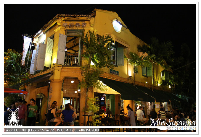
既然有湘群學姐當導遊,我們吃完晚飯就馬上開始活動,先去雞場街逛逛,畢竟次日得帶兩老出遊,可能走不了這麽多的行程。
After dinner, we went out to Jonker Street, a must-visit spot of Malacca. Continue reading

到了西馬,我們的第一站是馬六甲。到了吉隆坡國際機場KLIA,大妹來接機後,就直奔馬六甲。從機場到馬六甲約兩個小時路程,下午五點許到Hatten惠勝酒店,湘群導遊已經在等了。這輯是沿途的照片。
Malacca is our first destination in West Malaysia. When we arrived at KLIA, Jessie came to pick us up and drove us to Malacca. The journey took about 2 hours. We arrived Hatten Hotel around 17 pm. These are the pictures taken on the way. Continue reading

走完Silau-Silau森林步道,婆婆去陪公公,我們倆跟著Roy去參觀植物園。簡單地走了一圈,我們就去園區的Balsam餐廳享用自助午餐。
After jungle trekking, we visited the botanical garden of Kinabalu Park. Then, it’s time for lunch at Balsam Buffet Restaurant. Continue reading